About Westings Meadow
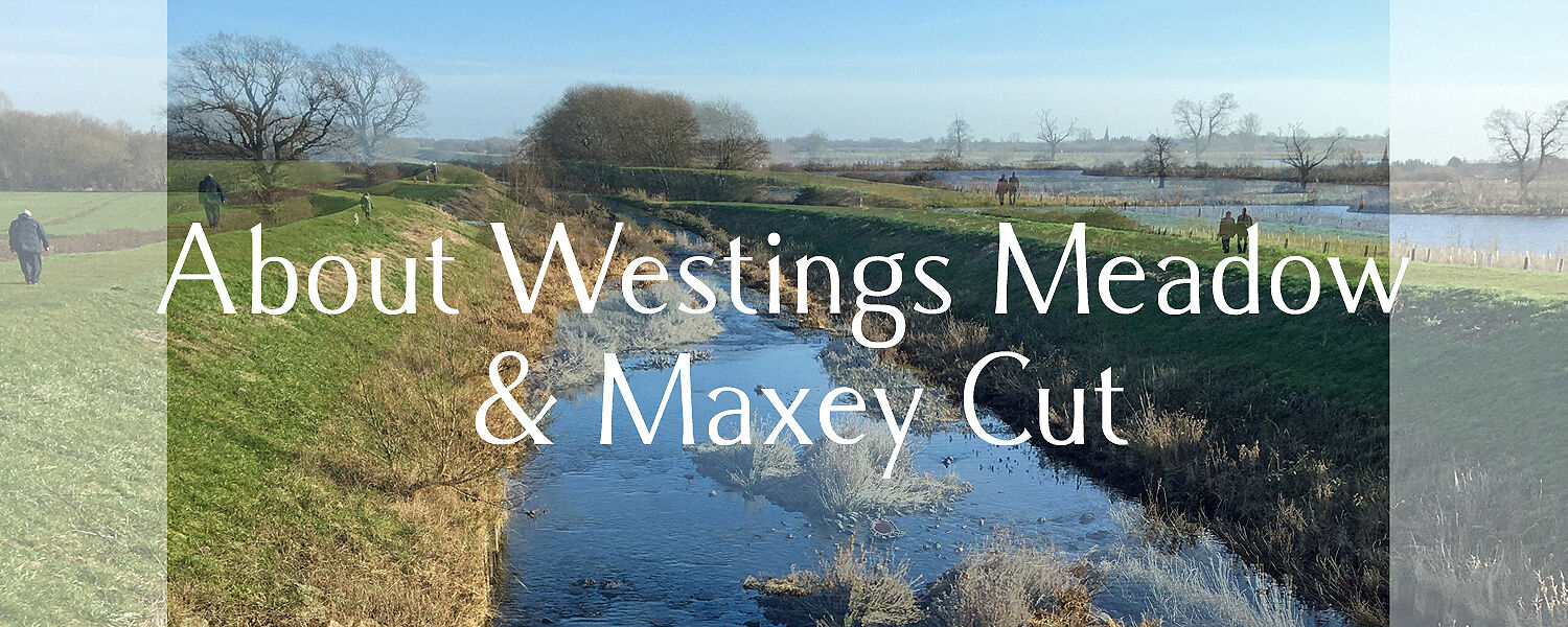
Over the last four years, with help from others in the local community, I’ve been exploring the history and biodiversity of Westings Meadow. Westings was a 500 acre meadow shared by the surrounding villages for over five centuries before being 'lost' in the early 1800s. The landscape has changed dramatically since then, with changes in farming, the creation of the Maxey Cut 70 years ago and subsequent gravel extraction and nature restoration... yet the story of Westings still lingers in the land.

Working with Art Pop-Up, from March to November 2026 we’ll be reconnecting community, memory and place through shared storytelling and exploring the heritage of this remarkable site. Events including free guided walks, online talks, community creative workshops and more - follow Art Pop-Up's Eventbrite page for details.
This project is made possible with The National Lottery Heritage Fund, with thanks to National Lottery players, alongside the Environment Agency. Huge thanks also to Langdyke Countryside Trust for allowing us access to their nature reserves.
More about Westings Meadow...
For over 500 years until the early 1800s, Westings Meadow was a three-mile long ribbon of meadow managed by the surrounding villages. It's mentioned in documents dating back as far as 1263! There's even a map dated 1580 showing a detailed survey of the meadow, though we don't know why it was drawn*.
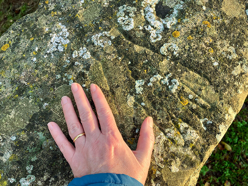
Poet John Clare played there as a child and in the 1840s he wrote about a walk from one end of Westings to the other. He describes the farmworkers, birds, plants and views. Clare even mentions the carvings on the meadow's old stone bridges, which he said were made by bored shepherds and cow-tending boys! Though very weathered now, the carvings can still be seen when the sun is bright and low. There are carvings of hands (below), shoes and some names.
Much further back in time, Bronze Age and Neolithic families worked this land too, farming sheep, holding summer gatherings and building their vast landscape of cursus, causeways and ring ditches beside a meandering fen-edge river. It was a very significant place for them... though perhaps they would have called it by a different name?
Westings' name seems to have fallen out of use during the early 1800s, when this land was Enclosed and made private. And before long, it seems this old place with its common rights was forgotten. From the mid-1950s, this land was once again shaped by humans on a huge scale, with the building of the Maxey Cut flood relief channel (below) to subsequent gravel extraction.

Nowadays, the historic location of Westings Meadow is a patchwork of farmland, quarry pits and fishing lakes with four nature reserves managed by Langdyke Countryside Trust.
The nature reserves are mainly ex-quarry sites, and they are living examples of how nature can recover given opportunity and a little help - as those who love this area will know, its biodiversity is very bit as rich as its history. There are Otters, migrating Sea Trout, rare moths, Glowworms, Starling murmurations, wild orchids and more!
In 2026, Art Pop-Up are leading a community project to gather and share more of the true stories of this land. I hope you'll follow our project via social media, or sign up for my (occasional) newsletters. If you have a memory of this land before the gravel extraction, we'd love to hear from you!
*With thanks to Dr Tracey Partida, who found the Tudor map of Westings Meadow which first sparked my interest. See Dr Partida's (2014) “Drawing the Lines: A GIS study of enclosure and landscape in Northamptonshire” (Doctoral dissertation, University of Huddersfield)